Add your organization to OuterSpatial. Get started now for free.
image.png

Nounou Trail (East)

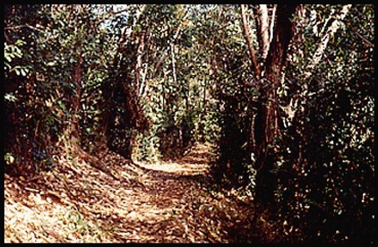
Trail in Nounou Forest Reserve

0 Reviews

Report

Report incorrect or missing information.

The trail starts at a parking area adjacent to the Department of Water pump site beside Haleilio road in Wailua Houselots. The trail ends at a picnic shelter on the "chest" of the Sleeping Giant in Nonou Forest Reserve, where there are vistas of the ocean coastline, as well as inland to the Wailua River and Mount Waialeale. The west side trail joins this trail near the 1.5 mile post.

Descriptions for route, history, plants and birds were provided by Stuart Ball, author of The Hikers Guide to Oahu and other hiking books.

Additional Information

Allowed Access
Dogs
Pedestrians
Activities
Hiking
Rules & Regulations
Carry Out Trash
Dogs On Leash
Pack Out Dog Waste
Stay On Trail
Special Conditions

Commercial use by permit only. Do not use any trail or access road that is not delineated by name and color and that may also be displayed on these maps. The marked features are managed for public recreational use. Other trails or roads that branch off from the public features may be on private property, and are not managed for any public recreational use. Access is subject to adjacent landowner approval, and if used without authorization, you will be trespassing and possibly putting yourself at risk. Downloadable resources are provided below.

Activities

  • Pedestrian
  • Tours

Amenities

  • Picnic Table
  • Shelter

Features

  • Nature Study

Hazards

  • Dangerous Cliff

Simple Trail Tips
  1. Stay of the trail 
  2. Check the weather 
  3. Watch the time 
  4. Avoid undue risk 
  5. Real all posted signs 
  6. Respect other trail users 
  7. Pack out at least what you pack in
Route Description

Climb the embankment on the right side of the parking lot to pick up the Nounou Mountain-East Side Trail. Ascend gradually along the slope on 14 switchbacks through a mixed forest of koa haole and Christmas berry trees. The trail descends briefly to skirt a rocky cliff and then resumes climbing. Switchback seven more times. Gain the ridgeline and turn left up it. Ascend the ridge, crossing from one side to the other on several switchbacks. Pass a bench down and on the left and then cross an eroded spot with views makai (seaward). Reach an unmarked junction in a stand of hala trees. Keep left along the ridge. (To the right the Nounou Mountain-West Side Trail descends to Kamalu Rd. [Rte 581]). Continue climbing past some ki (ti) plants. Reach a flat, grassy area with a bench, two covered picnic tables, and an impressive view mauka Descend and traverse a narrow saddle in the ridge. Reach the end of the official trail marked by a sign.

Dog Owners

Hunting may be in progress on or near this hiking trail. Hunting dogs may be off-leash while engaged in the hunt. Hikers must keep their dogs leashed at all times and remove dog waste while on this trail.

Plants & Birds

Check the boulders on the upper switchbacks for the native herb `ala`ala wai nui. It grows in low mats, which cling to moss covered rock and trees in moist, protected areas. The herb has small, succulent leaves and slender spikes bearing flowers and fruit. Early Hawaiians used the plant to make a gray-green dye and various medicines. At the junction with the west side trail is a small grove of hala trees. They have distinctive prop roots that help support the heavy clusters of leaves and fruit on the ends of the branches. Early Hawaiians braided the long, pointed leaves, called lau hala, into baskets, fans, floor mats, and sails. After the junction look for ki (ti) plants. They have shiny leaves, 1-2 feet long, which are arranged spirally in a cluster at the tip of a slender stem. Early Polynesian voyagers introduced ti to Hawai`i. They used the leaves for house thatch, skirts, sandals, and raincoats. Food to be cooked in an imu (underground oven) was first wrapped in ti leaves. A popular sport with the commoners was ho`he`e ki or ti-leaf sledding. The sap from ti plants stained canoes and surfboards. Before heading down, look for graceful koa`e kea or white-tailed tropicbirds, gliding overhead. They have two central tail feathers elongated into streamers. Tropicbirds feed by diving into the ocean for fish and squid. They nest in burrows or rock crevices along cliff faces.
Overview

  • Get Directions
    3772.24 mi Away
  • Lat/Lng
    22.06179, -159.34670
  • Length
    1.24 Miles