Add your organization to OuterSpatial. Get started now for free.
image.png

Mokuleia Trail

Trail in Mokulē‘ia Forest Reserve

0 Reviews

Report

Report incorrect or missing information.

Details

Length (one way): 3.5 mi / 5.63 km - Elevation Change: 1,200 ft / 365.76 m

General Summary:

Mokuleia Trail is a special access trail through the Air force facilities present in the area.

For additional information refer to the "Route description" below.

Additional Information

Allowed Access
Dogs
Pedestrians
Activities
Hiking
Rules & Regulations
Carry Out Trash
Dogs On Leash
Pack Out Dog Waste
Permit Required
Stay On Trail
Simple Trail Tips
  1. Stay on the trail. 
  2. Check the weather 
  3. Watch the time 
  4. Avoid undue risk 
  5. Read all posted signs 
  6. Respect other trail users 
  7. Pack out at least what you pack in.
Plants & Birds

After entering the reserve, watch for native alahe`e trees, which have oblong leaves that are shiny and dark green. Their fragrant white flowers grow in clusters at the branch tips. Early Hawaiians fashioned the hard wood into farming tools, and hooks and spears for fishing. Look also for native papala kepau trees, which are abundant in the reserve. They have large, leathery, oval leaves and clusters of small, white flowers. Early Hawaiians smeared glue from the sticky, ripe fruit on poles to catch native birds for their feathers. Craftsmen then fashioned capes and religious objects from the bright red and yellow feathers. The section from the shelter to the intermittent stream has a variety of native shrubs and trees, including `oh`ia, ko`ko`olau, ho`awa, maile, lama, kopiko, and kokio ke`oke`o. If the `ohi`a trees are in bloom, you may catch a glimpse of the native `apapane in the forest canopy. It has a red breast and head, black wings and tail, and a slightly curved black bill. In flight the `apapane makes a whirring sound as it darts from tree to tree searching for nectar and insects. Just across the stream is a fenced enclosure protecting the haha, a rare native lobeliad. The small tree resembles a palm with long elongated leaves bunched at the top. When in bloom, clusters of white tubular flowers droop from the central stalk below the leaves.

Special Conditions

Historically the Air Force has closed public access during RIMPAC in the month of July and on the anniversary of September 11. It is recommended that you call to check on the status of access in the event that the Air Force closes public access for security reasons. During these closures, you will not be able drive up the road through the Kaena Point Satellite Tracking Station at the Kaena State Park section of the Mauka Kaena State Park or Keawaula. The KPSTS land line is (808)697-4311 to check on potential closures. OVERNIGHT PARKING IS NOT ALLOWED AT OR AROUND THE AIR FORCE FACILITY. Campers may park overnight at the east trail head off of Kuaokala Road. Do not use any trail or access road that is not delineated by name and color and that may also be displayed on these maps. The marked features are managed for public recreational use. Other trails or roads that branch off from the public features may be on private property, and are not managed for any public recreational use. Access is subject to adjacent landowner approval, and if used without authorization, you will be trespassing and possibly putting yourself at risk. Downloadable resources are provided below.

Activities

  • Camping
  • Dog Hunting
  • Hiking

Amenities

  • Campsites

Features

  • Nature Study

Hazards

  • Dangerous Footing
  • Hunting Area

History

The Wahiawa Camp of the Civilian Conservation Corps constructed the Mokule`ia Trail in six months during 1934. The 5.2-mile route started by the wooden gate at the forest reserve boundary, climbed to just below the Wai`anae summit, and then contoured over to the end of the Kealia Access Road. The project was one of the easiest CCC trails to build because of the relatively dry and gentle terrain in this portion of the Wai`anae Range. Much of the original route has been replaced by the Mokule`ia and Kuaokala Firebreak Road, but the short section described above remains as a trail. The Mokule`ia Trail passes through the Pahole Natural Area Reserve. Established in 1981 on 658 acres, the reserve protects native plants and animals living in a lowland forest habitat. State Forestry and Wildlife workers and volunteers control invasive weeds there and plant native species suited to area. They also build protective fences around native tree snail colonies and especially rare plants.

Mountain Bikers

Always yield to hikers. Do not slide around corners or slide down the trail. Careless mountain biking damages the trail and causes erosion. If accidents are reported or damage to the trail is extreme, the trail may be closed to mountain bikers.

Dog Owners

Hunting may be in progress on or near this hiking trail. Hunting dogs may be off-leash while engaged in the hunt. Hikers must keep their dogs leashed at all times and remove dog waste while on this trail.

Terrain

Mountainous. Thick forest canopy

Route Description

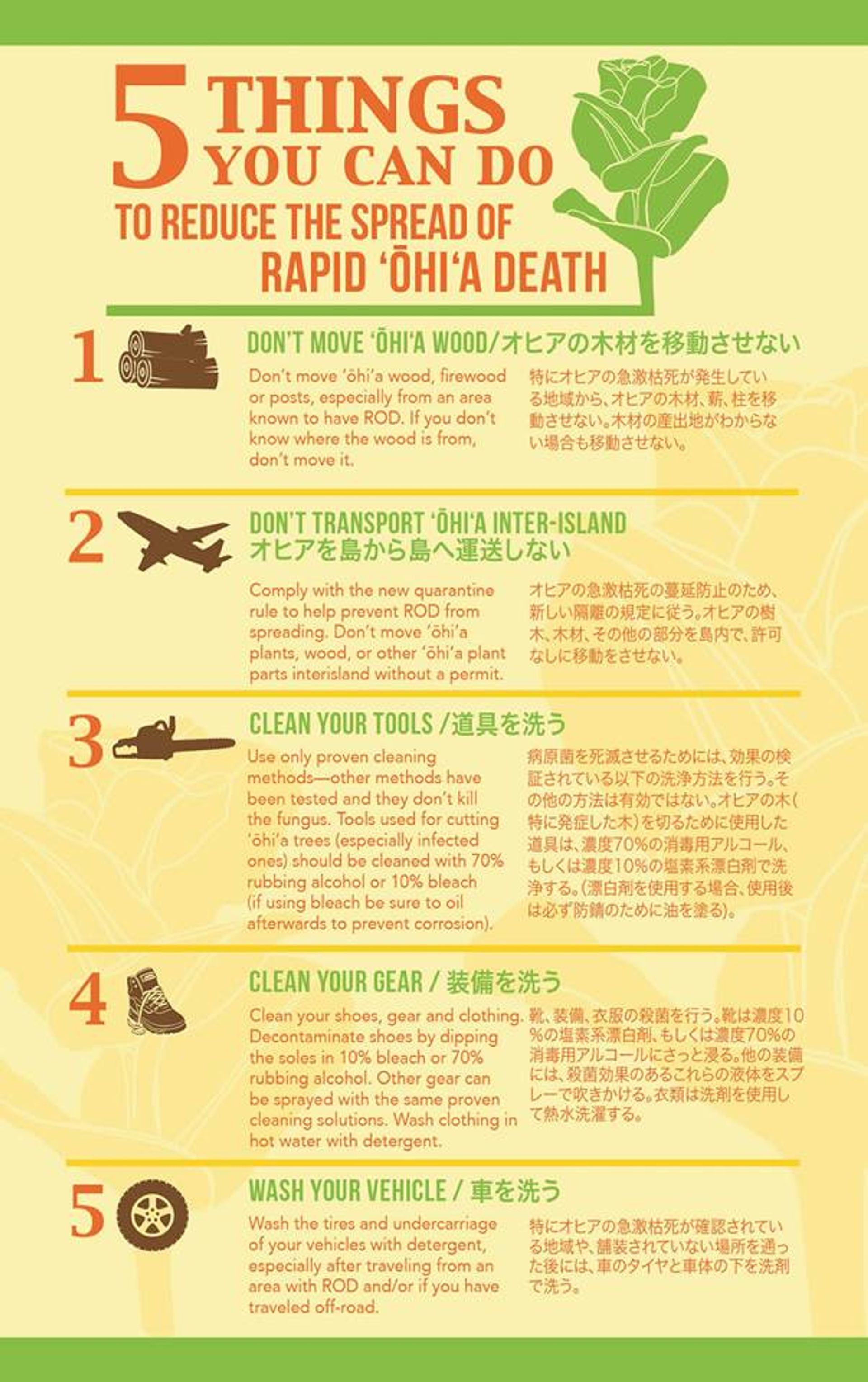
A permit and four-wheel drive is needed to access this trail through the Kaena Point Satellite Tracking Station Road (See Documents section below for hiking permit application). Mokuleia Trail goes through the Mokuleia Forest Reserve and the Pahole Natural Area Reserve (NAR), then crosses the Forest Reserve Boundary onto private land. This trail traverses a public hunting area - hikers should exercise caution. Wear bright colored clothing and be aware that you may encounter hunters who may be hunting off trail - stay on the trail. Please do not mountain bike on this trail - this trail is closed to mountain bikes. The Pahole NAR is a sensitive ecosystem and the Division of Forestry and Wildlife (DOFAW) is attempting to restore native vegetation that occurs in this area. Before hiking Mokuleia Trail, please check the soles of your shoes to assure that they are free of dirt and seeds. Seeds transported in this manner may inadvertently spread unwanted and invasive vegetation. There is also a boot brush provided at the trail head - please use it.

Descriptions for route, history, plants and birds were provided by Stuart Ball, author of The Hikers Guide to Oahu and other hiking books.

Directions

If you are driving, there are two ways to reach this trail: 1. From the Waianae side of O‘ahu: Drive towards Ka‘ena Point on Farrington Highway until you reach the Kaena State Park section of the Mauka Kaena State Park or Keawaula. Turn right and check in with your permit at the security guard station (see Documents section below for hiking permit application). Travel on the Kuoakala Access Road until you get to a paved road. Turn left until you get to the forest reserve gate. Prior to the gate, there is a road that turns right and is adjacent to the Peacock Flats camping area. This road also leads to the Mokuleia Trailhead. This following route requires a four-wheel drive and a permit to gain access through the Ka‘ena Point Tracking Station. 2. From Mokuleia: You may also access the Mokuleia Trail on foot or with a mountain bike via the Mokuleia Access Road. Mokuleia Access Road is closed to private vehicles. Head towards Ewa on H-1 and take the H-2 exit, heading towards Wahiawa and Haleiwa. As the freeway ends at Schofield Barracks, continue on Route 99 going north, bypassing Wahiawa. When the road forks, continue on the left fork towards Waialua (which is still Wilikina Drive, but now becomes Route 803). At the flashing yellow light, continue straight on Farrington Highway (Route 930). Continue on Farrington Highway, through the rotary, and through Mokuleia.

Descriptions for route, history, plants and birds were provided by Stuart Ball, author of The Hikers Guide to Oahu and other hiking books.

At the end of the Mokule`ia Forest Reserve Access Road, reach a signed junction at the forest reserve boundary. Turn left onto the Mokule`ia Trail, a dirt road leading through the campground at Peacock Flats. (The paved road continues straight to a junction with the Mokule`ia and Kuaokala Firebreak Road.) Pass the Earl Pan campground under stately Cook pines. Each campground has a pit toilet, but no water. Ascend gradually through a mixed introduced forest of Cook pines, eucalyptus, silk oak, and Christmas berry. On the left pass a small water catchment tank for wildlife. The road narrows to a trail at the boundary of Pahole Natural Area Reserve. Clean your boots of weed seeds with the brushes provided. Ascend steadily under arching Christmas berry. Go through a gate in a fence erected to keep feral pigs out of a section of the reserve. The fence line periodically parallels the trail on the right. By a bench reach an overlook of the north shore and flat Ka`ala, the highest peak on O`ahu. Reach a signed junction by a dilapidated shelter. Continue straight on the wide Mokule`ia Trail. (To the right a side trail leads to the Wai`anae summit. Turn left along a fence line there and climb briefly to an overlook of Makua Valley.) Descend gradually through native forest on two switchbacks. Cross a gulch with an intermittent stream and then traverse a level section. Cross another rocky gulch and begin contouring along the flank of the Wai`anae summit ridge. Wind through a flat area with abandoned citrus trees. Descend gradually through a eucalyptus forest. The trail initially follows the right side of the ridge and then switches over to the left. Reach a wooden gate, which marks the reserve boundary and the end of the Mokule`ia Trail. Below is private pastureland closed to the public.

Permit Requirements

Accessing this trail requires a day use permit issued by Hawaii’s Division of Forestry and Wildlife (DLNR). This permit must be printed in advance and in your possession at all times when on the trail. An additional copy must also be displayed on your vehicle dashboard when on the premises. 

Trail users may obtain permits through the following methods: Method 1 (Online-CURRENTLY INACTIVE) - A permit may be quickly obtained via the online link provided below. Trail users who use this method will be charged a $2.50 service fee for the online transaction. The permit will be issued automatically after purchase.

https://trails.ehawaii.gov/camping/all,details,57933.html

Method 2 (Via Mail) - Trail users who may not wish to pay the online service fee may manually send in an application, free of purchase, to the Department of Forestry and Wildlife, Oahu Branch. Please download and complete the form provided in the Resources section below (under Permit Application). Trail users may mail your application packet to: DLNR/ DOFAW 2135 Makiki Heights Dr. Honolulu, HI 96822 Permits will be issued after the completed application has been reviewed and approved. This may take up to 5 business days. 

Method 3 (Walk-In) - Permits are also issued same-day to trail users who wish to visit our DOFAW Makiki and Downtown offices. Walk-in permits are issued free of charge, and at the desk. Trail users may visit either of the following locations: 1151 Punchbowl St., Rm. 325 Honolulu, HI 96813 2135 Makiki Heights Dr. Honolulu, HI 96822