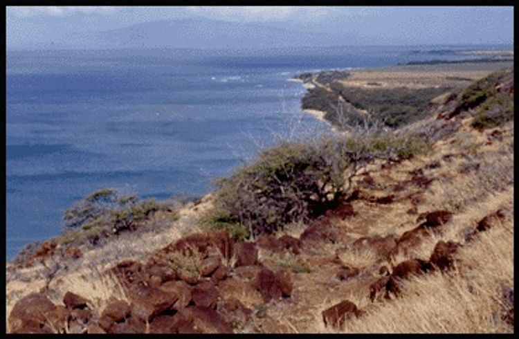
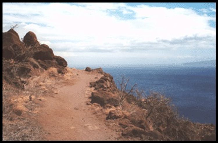
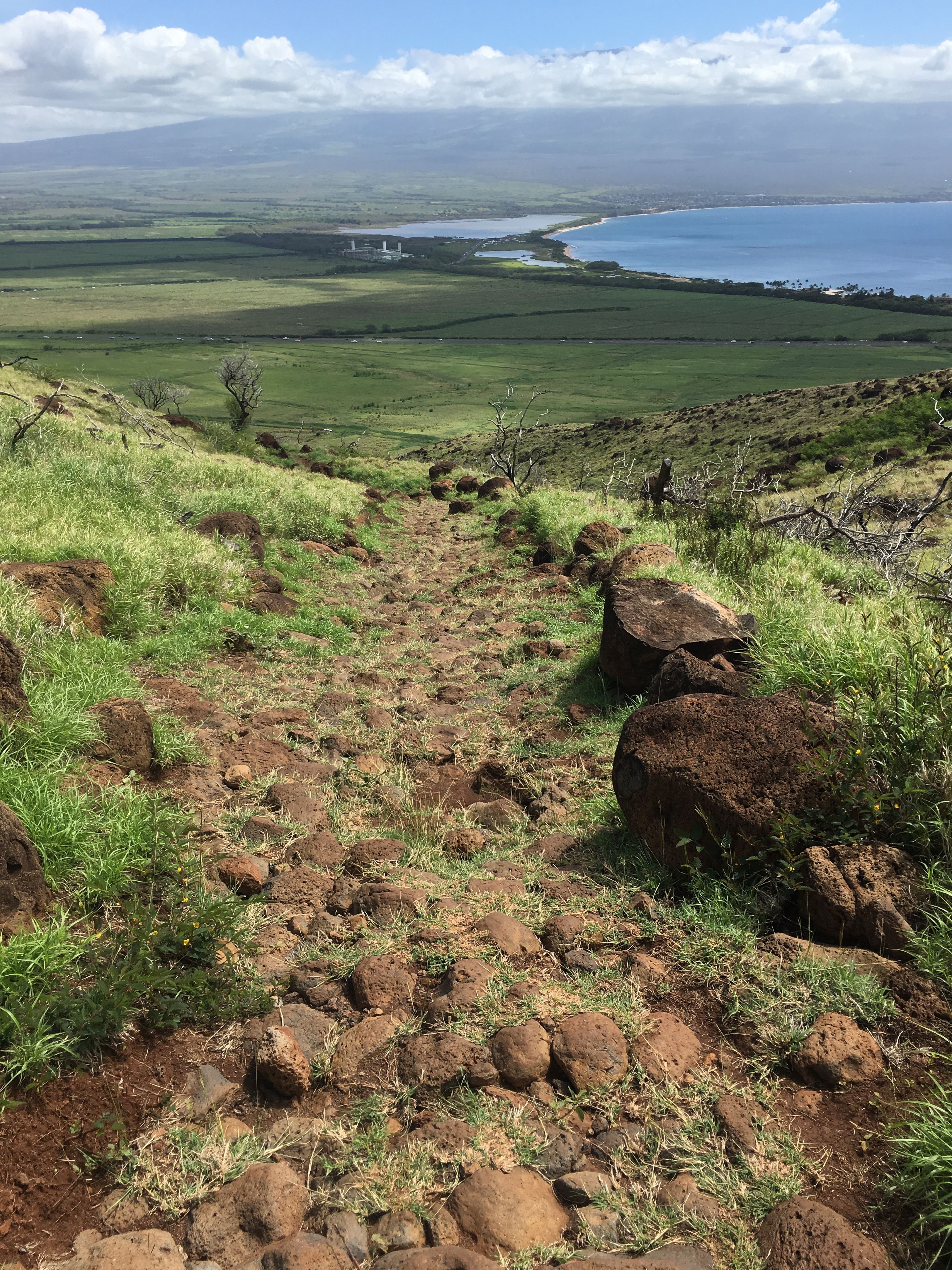
The Lahaina Pali trail runs from a point near Maalaea Harbor with refreshment stands and restrooms, over a ridge and down to a long, sandy beach with snorkeling, surfing and picnicking facilities. Ranging in elevation from 100' to 1,600', the trail offers excellent scenic vistas of Kahoolawe and Lanai islands. Whales can be observed during the winter months. Scrub vegetation at the lower elevations gives way to endemic dry-land plants as the trail climbs. The Old Lahaina Trail is part of the historic around-the-island trail system on Maui.

Additional Information
Allowed Access
Dogs
Pedestrians
Activities
Hiking
Rules & Regulations
Carry Out Trash
Dogs On Leash
Pack Out Dog Waste
Stay On Trail
Activities
- Hiking
- Pedestrian
Features
- Archaeology
- Ocean Scenery
- Open Views
- Scenic Viewpoint
Hazards
- Dangerous Footing
Simple Trail Tips
- Stay on the trail.
- Check the weather
- Watch the time
- Avoid undue risk
- Read all posted signs
- Respect other trail users
- Pack out at least what you pack in
Plants, Birds, & Whales
After the initial climb, scan the ocean for humpback whales. They migrate from the North Pacific to Maui, arriving in October and leaving in May. While in the Maui area they occupy themselves calving, nursing, breeding, and generally horsing around. While descending broad Kealaloloa Ridge, watch for two native shrubs, `ilima and `iliahialo`e, the coastal sandalwood. `Ilima has oblong, serrated leaves, about 1-inch long. The yellow orange flowers strung together have been used to make a regal lei, both in ancient and modern Hawai`i. `Iliahialo`e has oval, gray-green leaves about 1 to 2 inches long and tiny white star-shaped flowers. `Iliahialo`e is partially parasitic, with outgrowths on its roots that steal nutrients from nearby plants. Early Hawaiians ground the fragrant heartwood into a powder to perfume their kapa. Look for another native shrub, `a`ali`i, in Kaheawa pastures and lower down by the last gulch. It has shiny, narrow leaves and red seed capsules. Early Hawaiians used the leaves and capsules in making lei. When crushed, the capsules produced a red dye for decorating kapa (bark cloth).
Dog Owners
Hunting may be in progress on or near this hiking trail. Hunting dogs may be off-leash while engaged in the hunt. Hikers must keep their dogs leashed at all times and remove dog waste while on this trail.
History
In the early 1800s the Lahaina Pali Trail was constructed across the southern slopes of the West Maui Mountains. The trail provided a more direct route between the Wailuku and Lahaina districts. In 1900 prison laborers built a winding dirt road at the base of the pali near the coast. The trail fell into disuse as travelers preferred the ease of the dirt road and then the paved highway, constructed in 1951. The Lahaina Pali Trail was rebuilt by volunteers under the direction of Na Ala Hele, a state program involved in trail maintenance and access.
Terrain and Trail Environment
Rocky Shrubland
Route Description
At the back of the Ukumehame parking area take the trail past some information plaques. Climb briefly up Manawaipueo Gulch and then turn right on an old pali (cliff) road At a signed junction turn left off the road onto the Lahaina Pali Trail. Ascend steadily through grass-covered lava roughly paralleling the coast. Some sections still have the original rock pavement. Watch for graffiti cut in the rock by travelers long ago. The trail levels briefly by a shady kiawe tree above the tunnel portal. Look back to see Lahaina town and the island of Lana`i across `Au`au Channel. After crossing Kamaohi Gulch, the trail gradually works mauka (inland). Climb steeply alongside Mokumana Gulch and then cross it. Cross Opunaha Gulch and then shallow Makahuna and Ka`alaina Gulches. Descend gradually into rocky Manawainui Gulch and climb steeply out of the gulch on three switchbacks. Cross a line of wind turbines and their gravel access road. Interpretive signs explain the wind energy generation facility. Contour across a grassy area known as Kaheawa pastures to the highest point along the trail (elevation 1,600 feet). To the east Haleakala dominates the view. To its right is the islet of Molokini and the island of Kaho`olawe across `Alalakeiki Channel. After descending some stone stairs, reach a signed junction. Turn left on dirt McGregor Point Rd. Cross Malalowaiaole Gulch on the road. As the road swings sharp left up Kealaloloa Ridge, turn right and down on the Lahaina Pali Trail. Descend gradually along broad Kealaloloa Ridge, traversing a series of small gullies. Bear right and descend steadily down a side ridge. A gulch appears on the right. Along the coast are views of Ma`alaea Harbor, Kealia fishpond, and Kihei town. To the left of the sugarcane fields is Kahului town. Swing left away from the gulch and descend more gradually through scattered kiawe trees. Reach the Ma`alaea trailhead with its small gravel parking lot.
Directions
Both trail heads are accessible from Honoapiilani Highway (30). The eastern trail head lies 0.2 miles south of the junction of Honoapiilani Highway (30) and Kihei Road (31). Look for the closed, but unlocked gate. Please close the gate behind you. The western trail head lies 10 miles south of Lahaina and 3 miles west of Maalaea Harbor. The parking area is accessible from Highway 30 at Manawaipueo Gulch about 0.25 mile north of the Pali tunnel.
Special Conditions
Do not use any trail or access road that is not delineated by name and color and that may also be displayed on these maps. The marked features are managed for public recreational use. Other trails or roads that branch off from the public features may be on private property, and are not managed for any public recreational use. Access is subject to adjacent landowner approval, and if used without authorization, you will be trespassing and possibly putting yourself at risk.