Trail provides access to overlook where you can view waterfall of more than 600 ft.
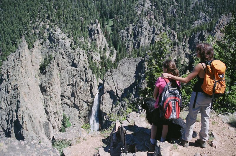
Bucking Mule Falls Trail
Point of Interest
0 Reviews
Claim
Share
Favorite
Social
Additional Information
Activities
Biking
Camping
Dog Walking
Horseback Riding
Walking
Hiking
Trail Running
National Recreation Trail Details
Length: 17 Miles
Loop Trail: No
Primary Trail Type: Backcountry
Additional Trail Types: -
Agency: USDA Forest Service
Entry Fee: -
Fee Notes: -
Parking Fee: -
Permit Fee: -
Trail Use Notes:
None
Seasonal Use Notes:
The access road (FSR 14) is passable around the end of June and the snow is too deep by the end of October.
Location: Bighorn National Forest
County: Big Horn
State: WY
Townships: -
Driving Directions:
35 miles from Lovell to Forest Road 14 on US highway 14A, 12 miles on Forest Road 14 to Bucking Mule Falls Trailhead.
Average Grade: 20%
Maximum Grade: -
Elevation High: 9000 Feet
Elevation Low: 5200 Feet
Elevation Gain: -
Average Width: 24 Inches
Minimum Width: -
Primary Surface: Soil
Additional Surfaces: Soil
Year Designated: 1979