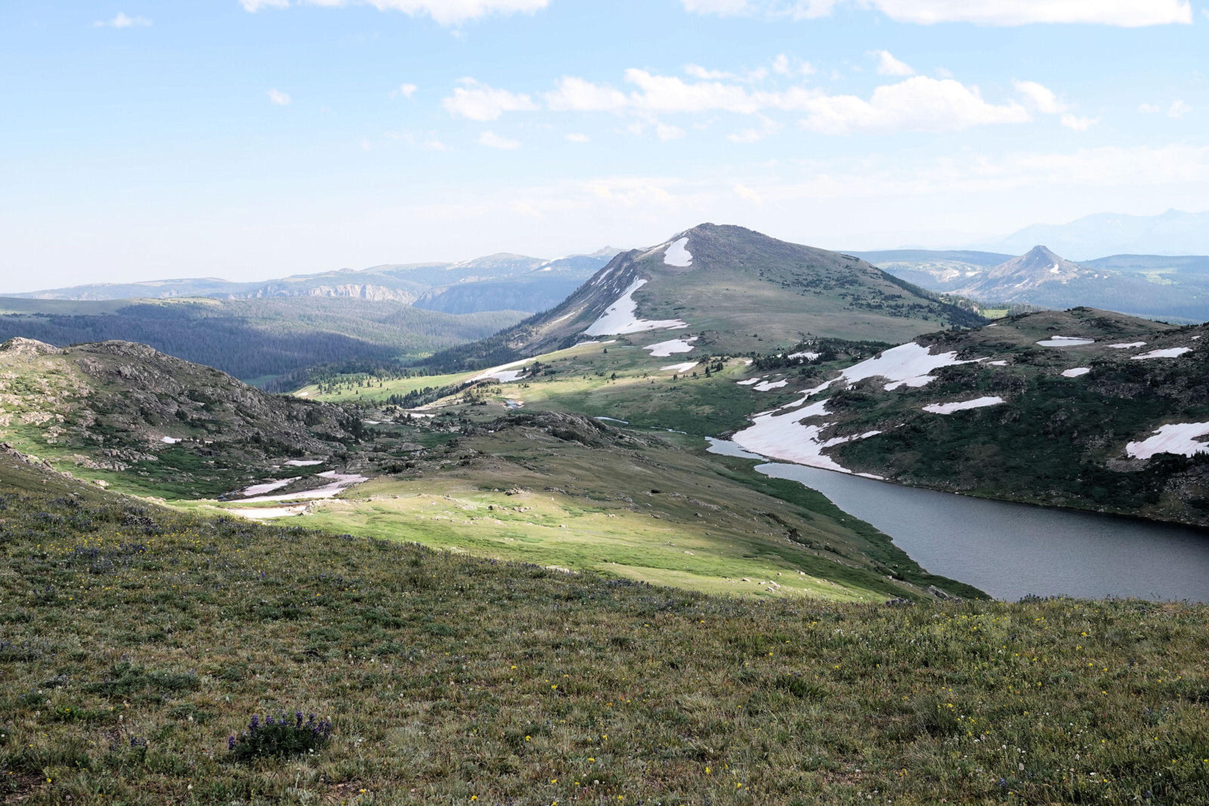
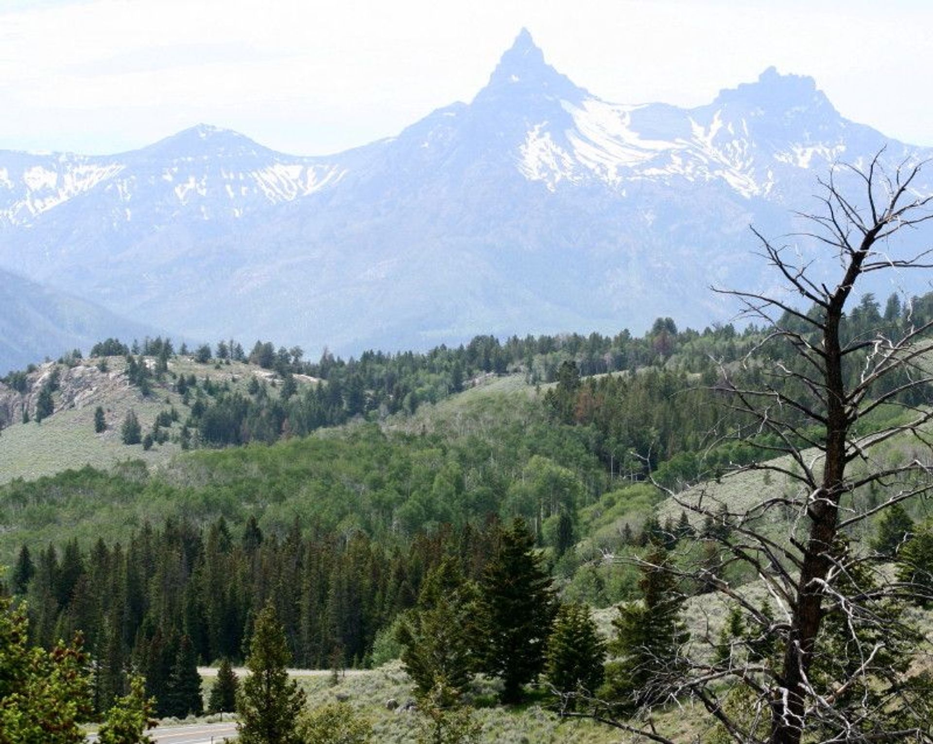
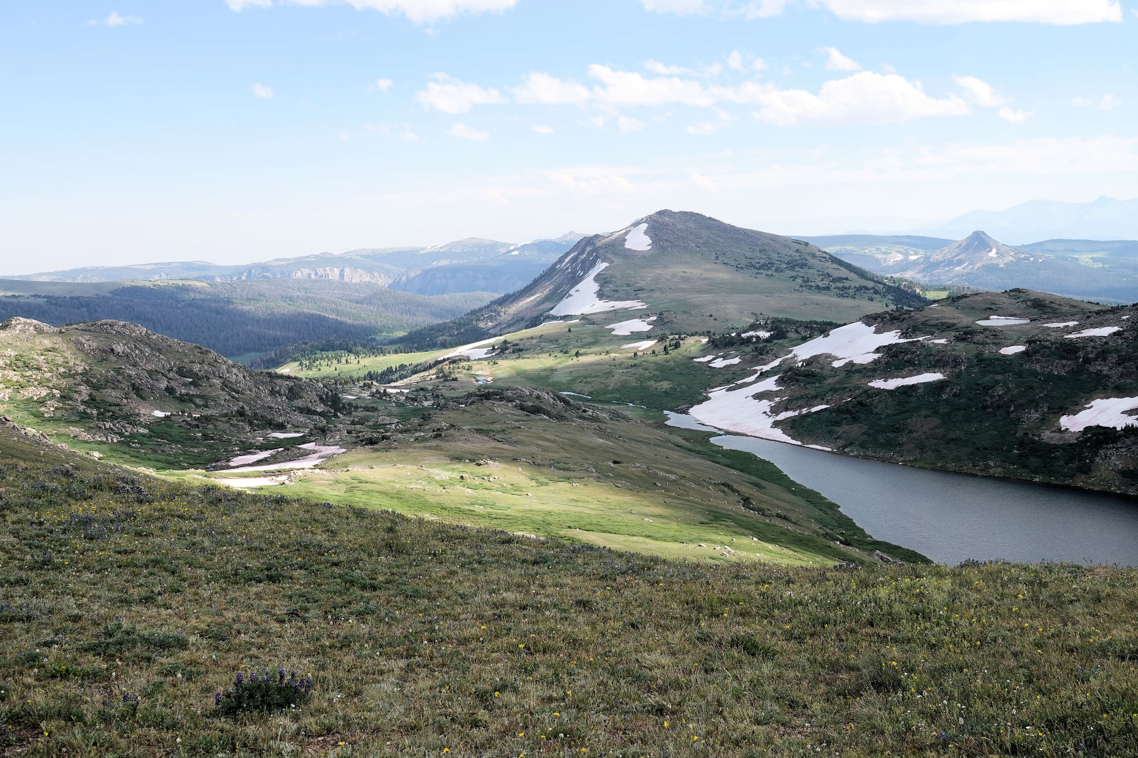
The Beartooth Loop trail is a scenic loop trail that originates near the Gardner headwall, a well-known geologic feature adjacent to the Beartooth All American Highway. This trail traverses a scenic piece of the alpine and sub-alpine Beartooth Plateau. After a relatively steep plunge from the Highway to Gardner Lake, the trail follows a relatively gentle grade in a large loop. In addition to stunning scenery, the trail takes users in close proximity to three large lakes noted for small but hungry fish. The fauna of the area includes pike, marmots, mule deer, raptors and occasionally a grizzly bear or wolf which inhabit the wilds adjacent to the trail. The trail serves as a compliment to the scenic Beartooth All American road which traverses the Plateau and on to Yellowstone National Park.
Beartooth Loop Trail
Point of Interest
Additional Information
Activities
National Recreation Trail Details
Length: 9.7 Miles
Loop Trail: No
Primary Trail Type: Backcountry
Additional Trail Types: -
Agency: USDA Forest Service
Entry Fee: -
Fee Notes: -
Parking Fee: 5
Permit Fee: -
Trail Use Notes:
Bicycling - Any (Non-Wilderness Only), Wildlife Observation - Mammals, Motorized Vehicles - Motorcycling (Non-Wilderness Only), Motorized Vehicles - Snowmobing (Non-Wilderness Only)
Seasonal Use Notes:
None
Location: Shoshone National Forest, Rocky Mountain Park
County: -
State: WY
Townships: -
Driving Directions:
38 miles W of Red Lodge, MT on US 212 or 16.5 miles NW of Cody,on Hwy 120 to Sunlight Basin Road - 51 miles. To US 212 junction. Go E on 212 to Hauser (n. of Hauser lake, on Beartooth Hwy), Gardner (above Gardner Lake) or Dollar Lake (access by 4WD) trailheads.
Average Grade: 10%
Maximum Grade: 30%
Elevation High: 10530 Feet
Elevation Low: 8900 Feet
Elevation Gain: -
Average Width: 18 Inches
Minimum Width: -
Primary Surface: Soil
Additional Surfaces: Soil
Year Designated: 1979