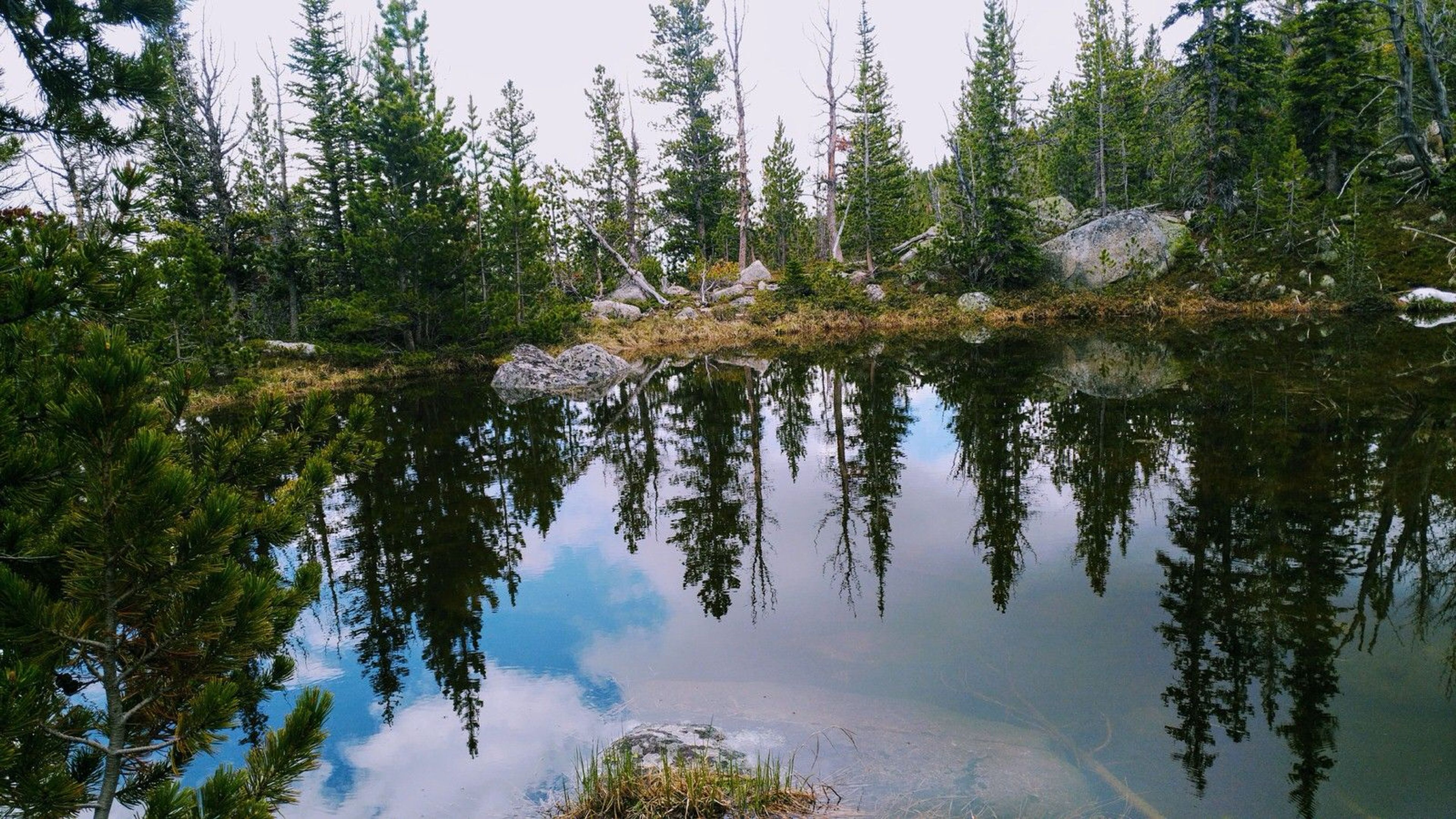
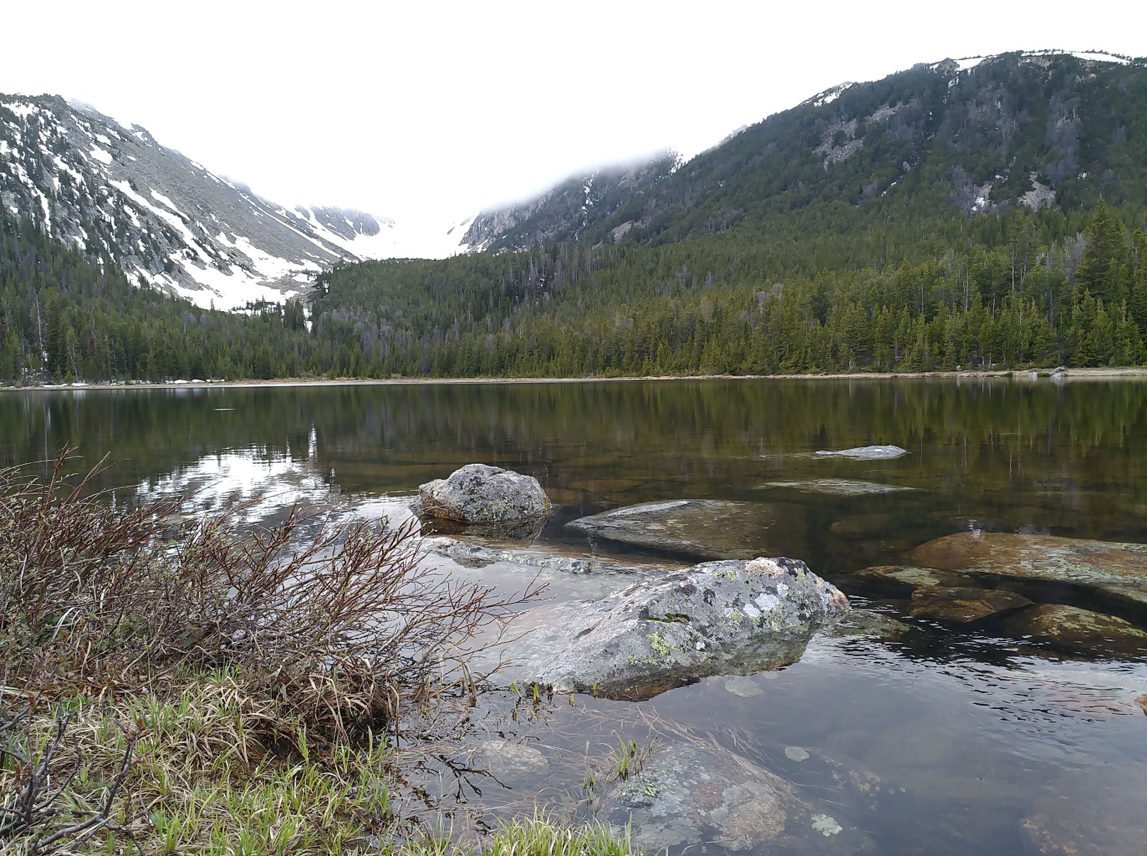
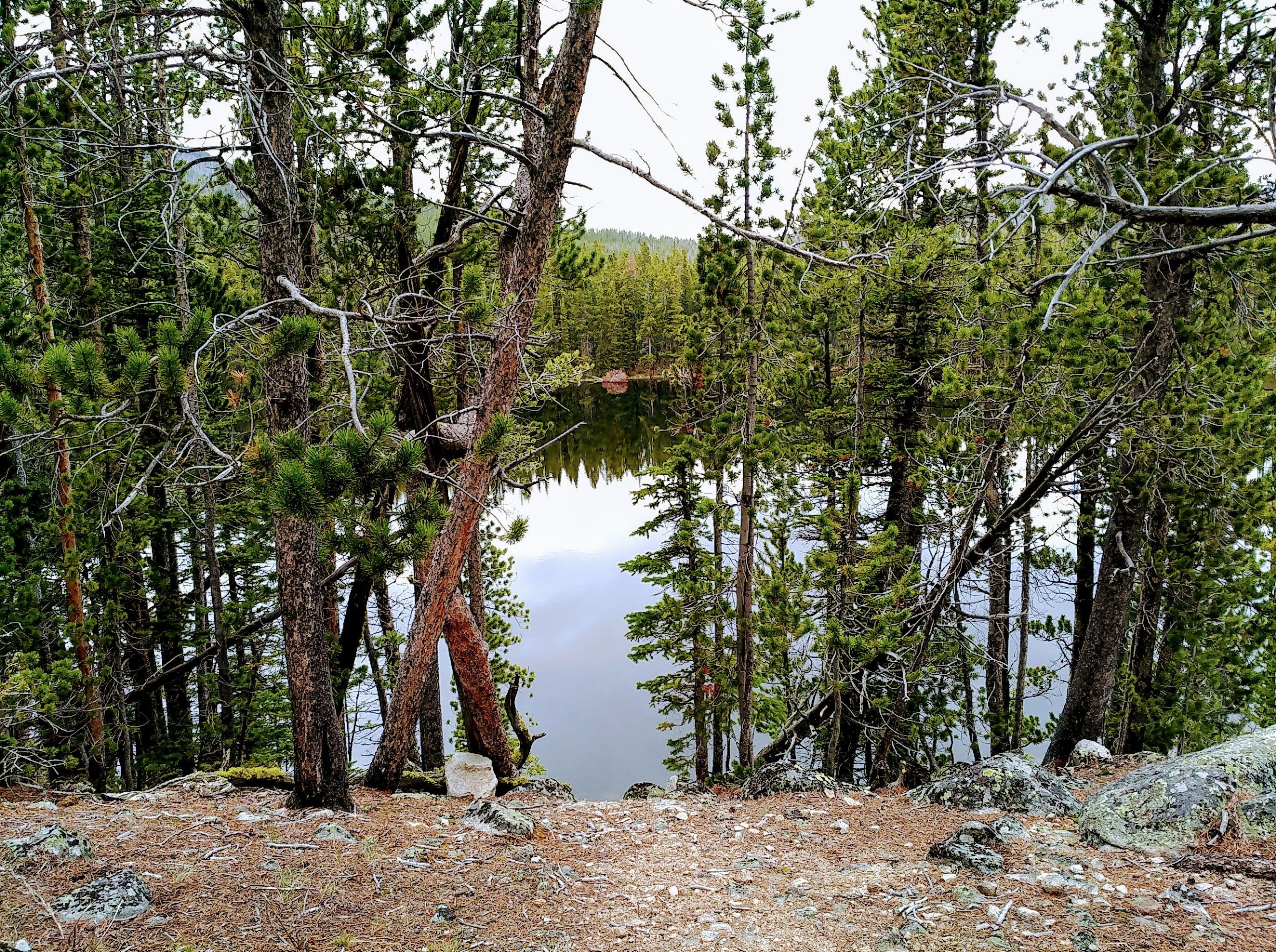
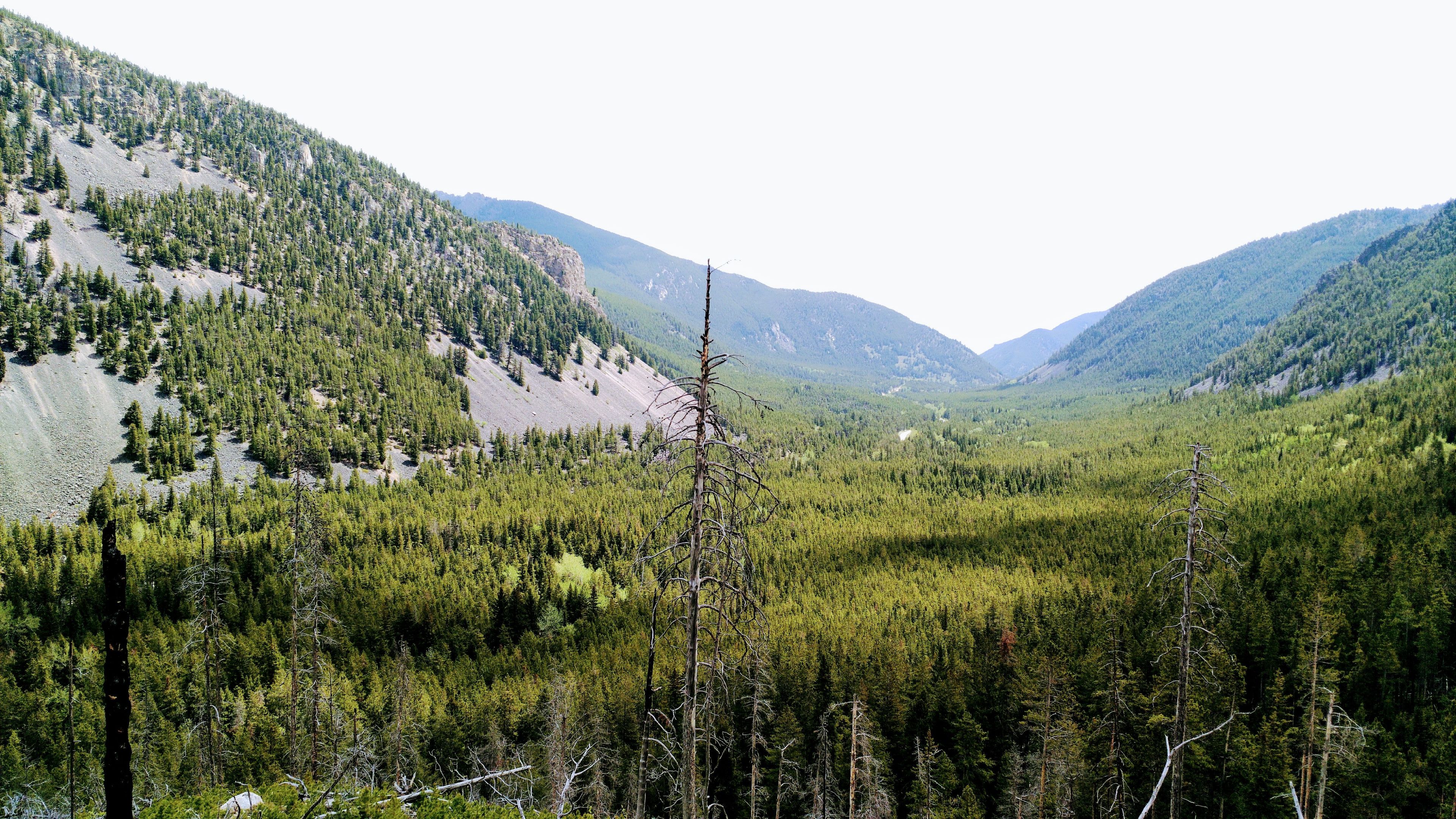
Basin Lakes National Recreation Trail (# 61) is 4 miles long. The trail is a steady forested climb to upper and lower Basin Lakes passing a waterfall along the way. Lower Basin Lake is partially covered with lily pads and Upper Basin Lake offers scenic views of the surrounding mountains.
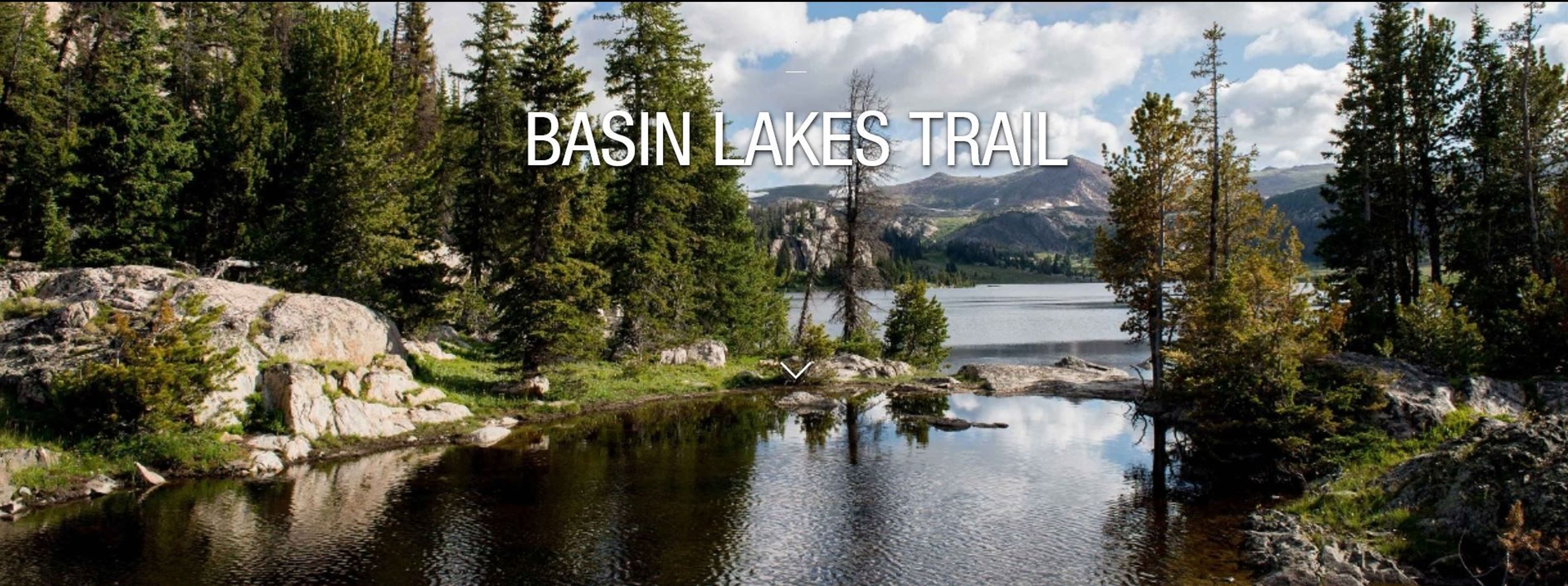
Basin Lake Trail
Point of Interest
0 Reviews
Claim
Share
Favorite
Social
Additional Information
Activities
Camping
Dog Walking
Fishing
Walking
Hiking
Trail Running
Cross Country Skiing
Snowshoeing
Wildlife Watching
National Recreation Trail Details
Length: 4.8 Miles
Loop Trail: No
Primary Trail Type: Backcountry, Snow Trail
Additional Trail Types: -
Agency: USDA Forest Service
Entry Fee: -
Fee Notes: -
Parking Fee: -
Permit Fee: -
Trail Use Notes:
Trail open to horses during big game season only.
Seasonal Use Notes:
None
Location: 8 miles west of Red Lodge, MT., In Custer National Forest, 8 mi. W of Red Lodge on West Fork Rock Creek Road.
County: Carbon
State: MT
Townships: -
Driving Directions:
Drive north on US Hwy 212 towards Red Lodge for 0.3 miles. Turn west (left) onto the West Fork Rd and drive 2.8 miles. Stay to the left (follow signs) and continue on the West Fork Rd. Drive 4.1 miles to Basin Lakes trailhead on your left.
Basin Trailhead provides access to Basin Lakes National Recreation Trail (# 61) and the west side of the Silver Run Trail (# 102) via the Basin Spur Trail (# 61A). There is ample parking and a vault toilet at the trailhead.
Average Grade: 5%
Maximum Grade: 5%
Elevation High: 9000 Feet
Elevation Low: 6902 Feet
Elevation Gain: -
Average Width: 18 Inches
Minimum Width: -
Primary Surface: Soil
Additional Surfaces: Soil
Year Designated: 1979
Websites
Stewardships
 In Partnership WithAmerican Trails