Add your organization to OuterSpatial. Get started now for free.
Apple Orchard Falls

Apple Orchard Falls

Point of Interest 

0 Reviews
Claim

Report

Report incorrect or missing information.

For the most part, these are excellent hiking trails for members of the whole family, young and old alike. These trails are easy to moderate in most places, but some stretches are difficult. Read the descriptions below to plan your hike.

The easiest route is from the bottom at the end of FS 59 along North Creek to the falls, although the last ½ mile gets rocky and steeper. From the falls to the Blue Ridge Parkway the trail is steep. You will see rhododendron, turtle head, mountain fetterbush, trillium, bleeding heart, and showy orchis, as well as many other plants. North Creek is home to a rare species of aquatic lichen, the waterfan.

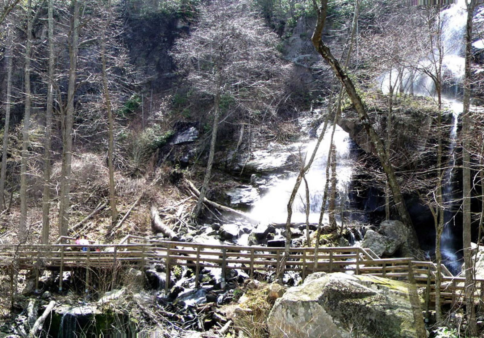
Safety First: There are several bridge crossings on these trails; some have several steps at each end. Beware of slippery rocks and please stay on the trail. There is a safe viewing area at the falls. Do not attempt to climb the rocks around the falls as they wet, slippery, and very dangerous. Always carry a snack, water, and a light raincoat, and wear (comfortable) hiking boots, when hiking.

Additional Information

Activities
Walking
Hiking
Trail Running
National Recreation Trail Details

Length: 3.5 Miles
Loop Trail: No
Primary Trail Type: Backcountry
Additional Trail Types: -
Agency: USDA Forest Service
Entry Fee: -
Fee Notes: -
Parking Fee: -
Permit Fee: -

Trail Use Notes:
None

Seasonal Use Notes:
None

Location: Connects to AT and Sunset Field overlook on the Blue Ridge Parkway. George Washington & Jefferson National Forests
County: -
State: VA
Townships: -

Driving Directions:
This trail begins at an elevation of 3'500 feet on the Blue Ridge Parkway at Sunset Field Overlook near milepost 78. It leads in a northwesterly direction, crossing into the Jefferson National Forest at 0.1 mile, crossing the Appalachian Trail at 0.2 mile and a seeded logging road at 0.8 mile. At 1.1 miles the trail passes a huge overhanging rock on the right that would give shelter from rain. It begins a steep descent around the falls at 1.2 miles. At 1.4 miles, look back for a beautiful view of a 200-foot high falls. The trail leads into the headwaters of North Creek, following old woods road downstream. At approximately 3.4 miles, the northwest end of the trail (elevation 1500) joins FS Road 59 at the end of Cornelius Creek Trail. The trail can also be accessed from FS Road 59. From Interstate 81 take the Arcadia exit (exit 168). Follow Route 614 approximately 3 miles to FS Road 59. It is 4.5 miles to the trailhead at end of FS 59.

Average Grade: -
Maximum Grade: -
Elevation High: -
Elevation Low: -
Elevation Gain: -

Average Width: 24 Inches
Minimum Width: -
Primary Surface: -
Additional Surfaces: -

Year Designated: 1987

Overview

  • Get Directions
    252.91 mi Away
  • Lat/Lng
    37.50779, -79.52407
  • what3words
    ///fumble.initiates.limbs