Add your organization to OuterSpatial. Get started now for free.
image.jpg

Hood Mountain Regional Park and Open Space Preserve

Area 

0 Reviews
Claim

Report

Report incorrect or missing information.

THIS PARK IS PARTIALLY CLOSED DUE TO WILDFIRE DAMAGE.

NOTE: Hood Mountain Regional Park remains partially closed due to impacts of the 2020 Glass fire. The Pythian Road upper parking lot, a section of Lower Johnson Trail, and the entire Lawson Trail are open. The Nattkemper Trail to Gunsight Rock is also open, accessed via the Goodspeed Trail in Sugarloaf Ridge State Park. No other Hood Mountain trails are open. The Los Alamos Road entrance is closed. 

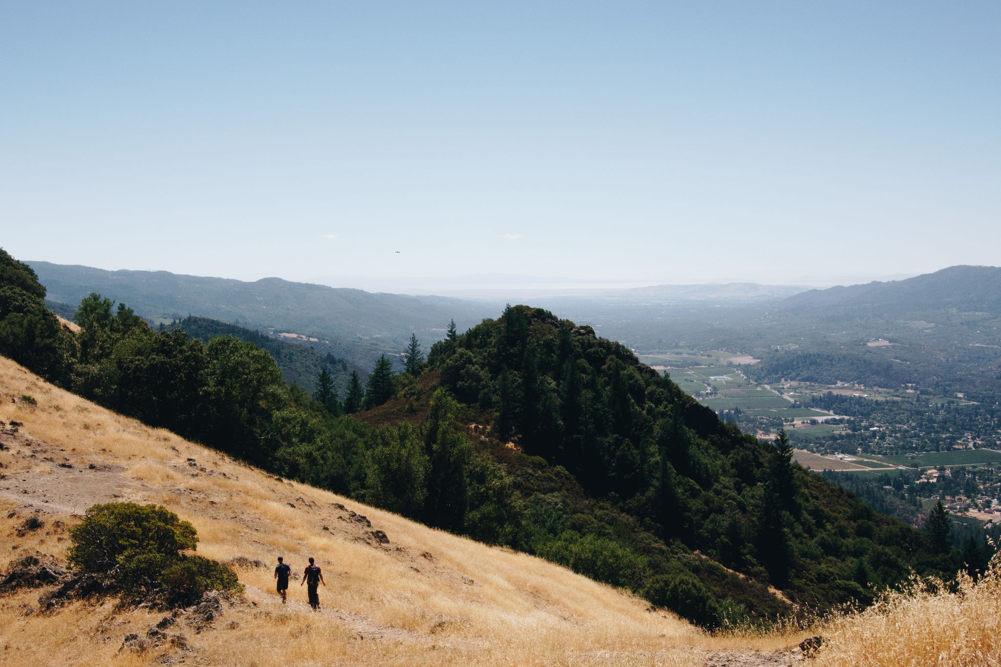
Hood Mountain Regional Park & Preserve is a 2,000-acre wilderness park on the edge of the Sonoma Valley, about 5 miles southeast of Santa Rosa. The park offers more than 19 miles of trails for hikers, mountain bikers and equestrians.

At 2,730 feet, Hood Mountain is the highest peak in the Mayacamas Mountains. Its Gunsight Rock outcropping above Highway 12 offers stunning views of the Sonoma Valley and beyond. 

More info at http://parks.sonomacounty.ca.gov/Visit/Hood-Mountain-Regional-Park/Trails/

Additional Information

Good For
Dogs
Families
Activities
Hiking
Birdwatching
Horseback Riding
Photography
Picnicking
Mountain Biking
Rules & Regulations
Dogs On Leash
Accessibility Description

Hood Mountain trails are rugged. Always travel with another person. Water is not available in the park, so be sure to bring sufficient water.

Environmental campsites are available by reservation and can be reached by hiking approximately 2 miles from parking areas.

Access the park's northwest side through Los Alamos Road (currently closed). Access the park's southwest side through Pythian Road (1450 Pythian Road, Santa Rosa). The Pythian Road entrance to Hood Mountain Regional Park may close during high-wind advisories or storm conditions.

Trails

NOTE:

THIS PARK IS PARTIALLY CLOSED DUE TO WILDFIRE DAMAGE.

Hood Mountain Regional Park remains partially closed due to impacts of the 2020 Glass fire. The Pythian Road upper parking lot, a section of Lower Johnson Trail, and the entire Lawson Trail are open. The Nattkemper Trail to Gunsight Rock is also open, accessed via the Goodspeed Trail in Sugarloaf Ridge State Park. No other Hood Mountain trails are open. The Los Alamos Road entrance is closed.

Hood Mountain Regional Park contains more than 19 miles of trails, the most extensive trail system within the Sonoma County Regional Parks system. Trails climb through mixed-conifer forests, over meadows, and cross several creeks, including the headwaters of Santa Rosa Creek.

Terrain is challenging, but the effort can be rewarded with views of both the Sonoma and Napa sides of the Mayacamas Mountains as well as views of Bay Area landmarks on clear days. Most trails are considered strenuous, so please plan for ample time to complete hikes.

The newest trail to open at Hood Mountain is the Lawson Trail, which provides several great vista points of the Sonoma Valley, Napa hills and San Francisco and San Pablo bays. The Lawson Trail can be reached by following the Lower Johnson Ridge Trail from the Pythian Road parking lot.

One of the most popular hikes is to Hood's Gunsight Rock overlook, which is reached from Hood Mountain's summit. The summit can be reached via several approaches within the park or from adjacent Sugarloaf Ridge State Park. (Leashed dogs are welcome at Hood Mountain, but are not allowed on Sugarloaf trails.)

A popular, easy-level hike is to Santa Rosa Creek from the Los Alamos Road entrance.

Overview

  • Get Directions
    1342.00 mi Away
  • Lat/Lng
    38.46669, -122.56444
  • Size
    2007.89 Acres

Stewardships