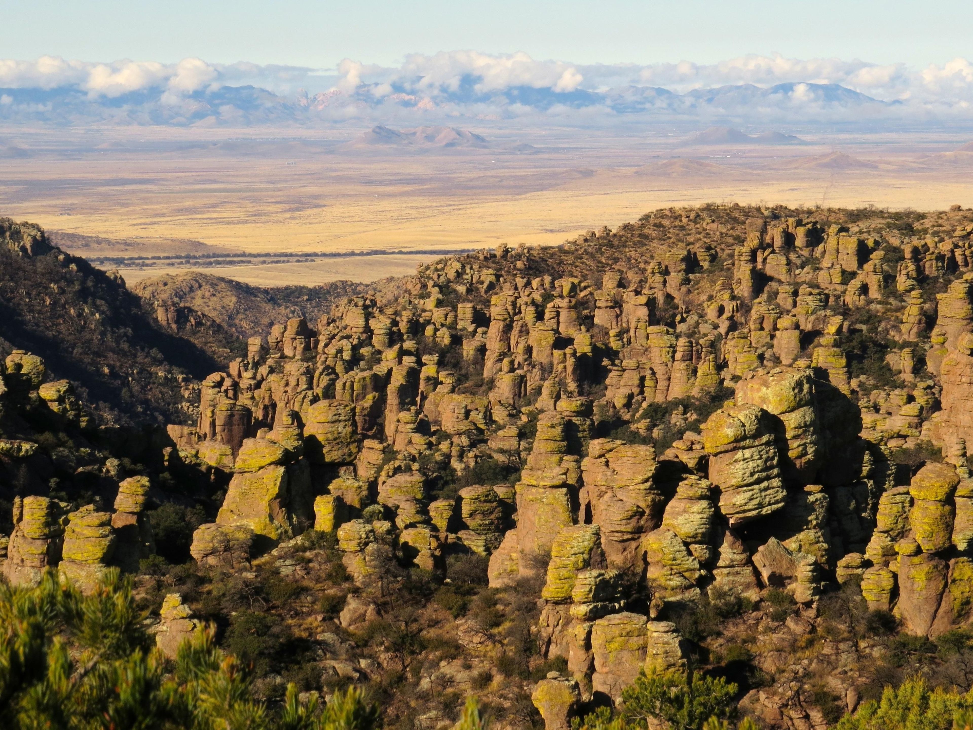
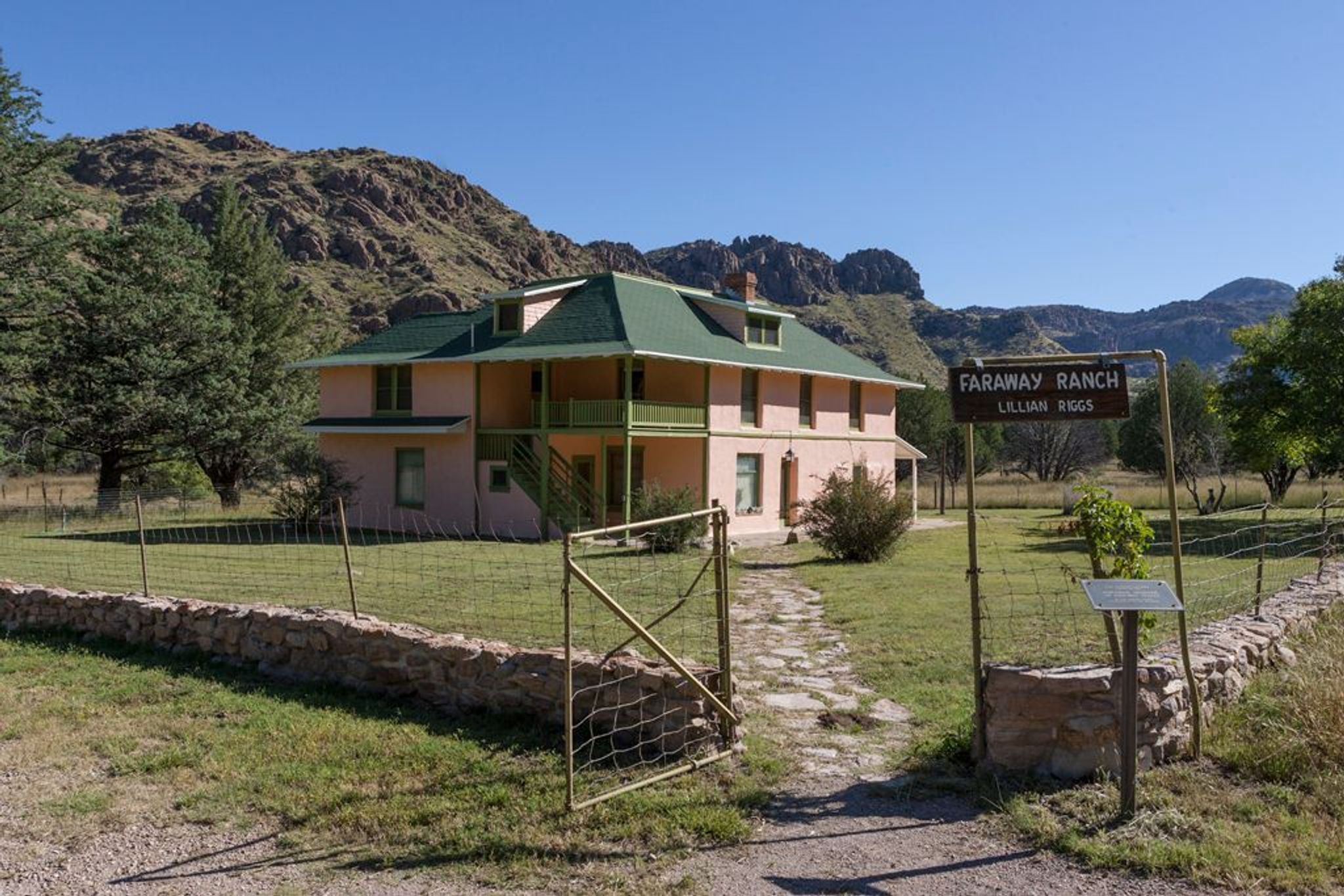
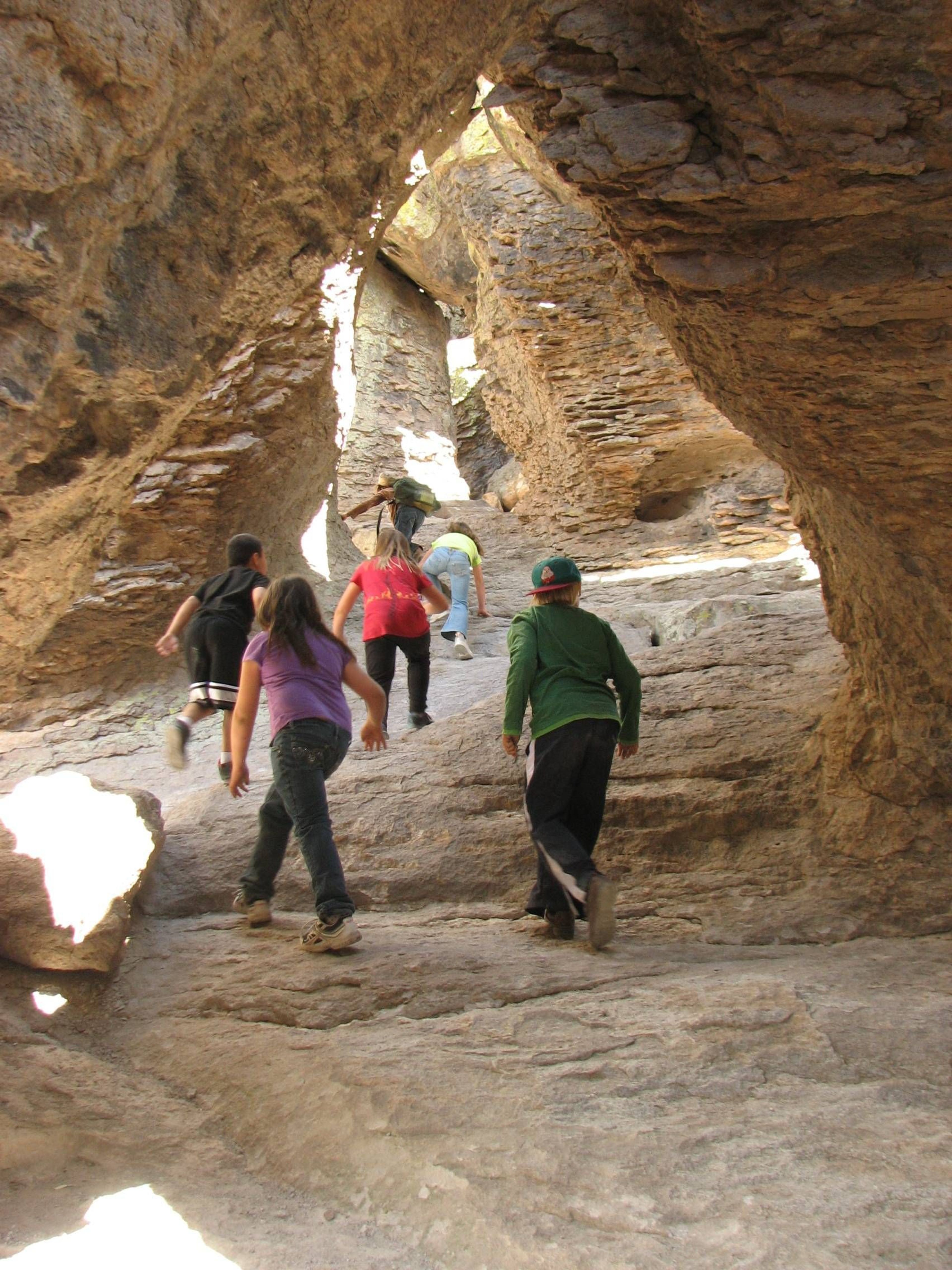
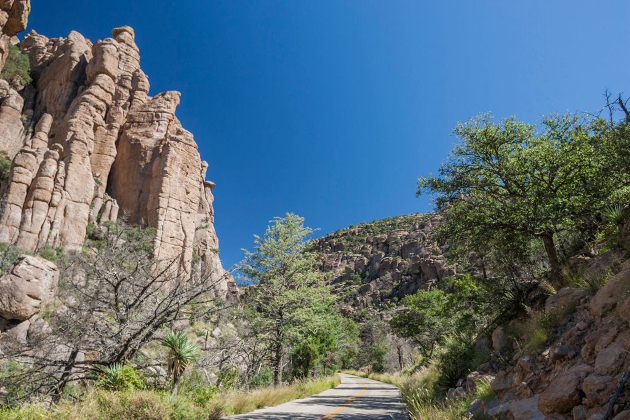
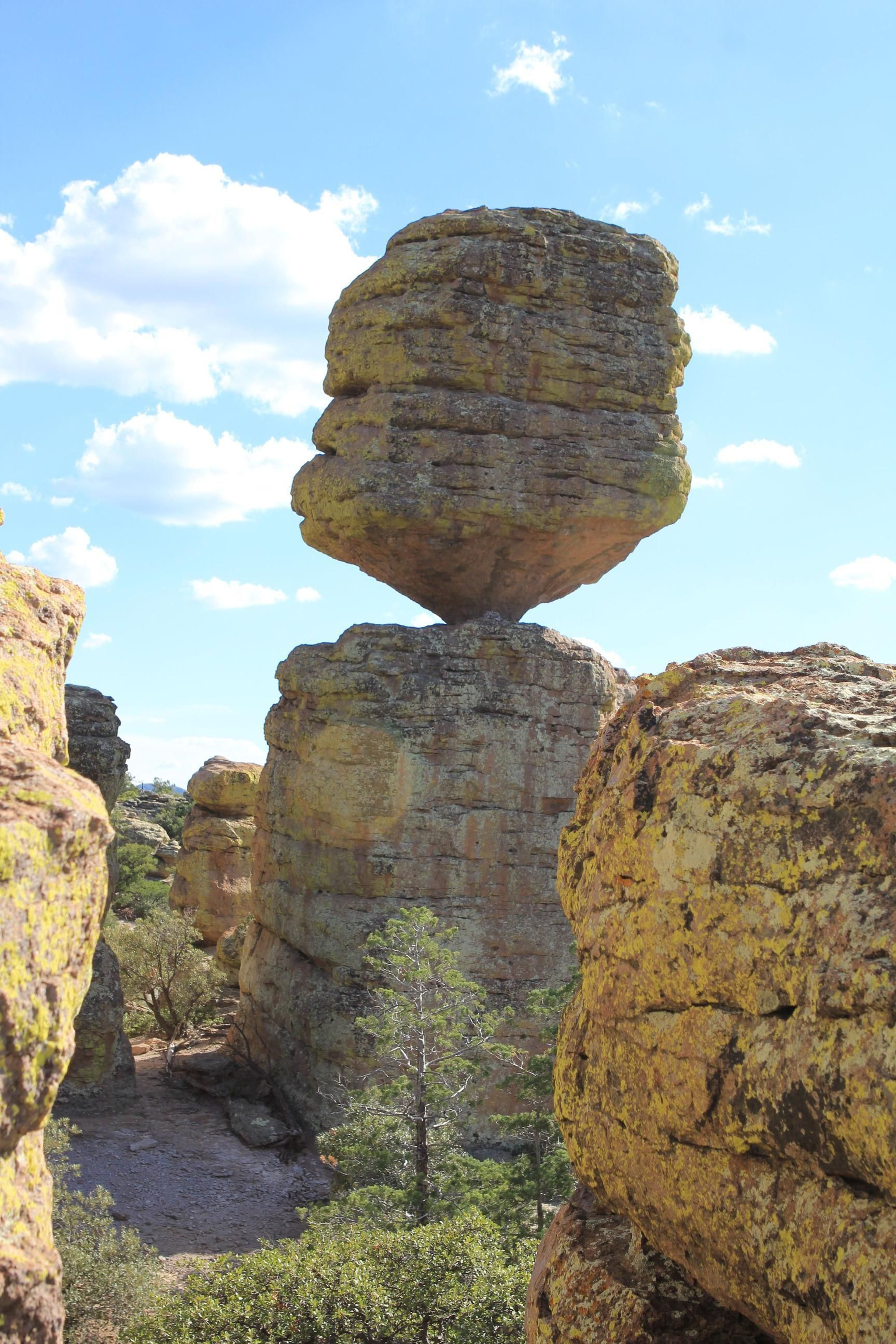
A "Wonderland of Rocks" is waiting for you to explore at Chiricahua National Monument. The 8-mile paved scenic drive and 17-miles of day-use hiking trails provide opportunities to discover the beauty, natural sounds, and inhabitants of this 12,025 acre site. Visit the Faraway Ranch Historic District to discover more about the people who have called this area home.
Chiricahua National Monument
Area
0 Reviews
Claim
Share
Favorite
Social
Additional Information
Good For
Wheelchairs
Families
Hearing Impaired
Visually Impaired
Activities
Hiking
Tent Camping
Birdwatching
Wildlife Watching
Biking
Fishing
Stargazing
Camping
Guided Tours
Accessibility Description
Chiricahua National Monument is continually working to improve access so that everyone can experience this unique landscape. If you have special needs or particular questions, please contact a staff member at 520-824-3560 or email us.
Visitor Center
Open daily, the building and rest rooms are fully accessible. A short captioned introductory film is shown on request.
Camping at Bonita Canyon Campground
Reserve an accessible campsite – site 8 – at Chiricahua’s only campground. Facilities include easy access to accessible rest rooms, picnic tables and fire rings. Learn more about Bonita Canyon Campground.
Picnicking at Chiricahua
Bonita Creek is an accessible picnic area with a hardened trail to a nearby accessible restroom. An accessible picnic table is available at the Massai Point picnic area near the parking lot.
Chiricahua Entrance Fee
Entrance fee is $0.00.
Chiricahua National Monument is a fee free park. No entrance fee is required.
Weather
Chiricahua National Monument ranges from 5,124 feet / 1,562 meters in elevation at the entrance station to 7,310 feet / 2,228 meters at the summit of Sugarloaf Mountain. You can enjoy the differences of four seasons. http://www.nps.gov/chir/planyourvisit/weather.htm
Directions
Chiricahua National Monument is located 120 miles southeast of Tucson. Take I-10 east from Tucson to the first exit for Willcox. Travel 3 miles into town to the stoplight and turn right. You will follow Arizona State Highway 186 for 32 miles to the junction of Arizona State Highway 181. Turn left and 4 miles later you will be at the Chiricahua entrance station. Maximum vehicle length is 29 feet to drive beyond the visitor center. A hiking shuttle is available daily at 9 am from the visitor center.